Rim-to-Rim-to-Rim (aka: R2R2R)
** Editors Note** While this is a lengthy Race Report – It is completely worth the read! Step inside the mind and journey of Endurance Nation athlete, John Withrow as he tackles yet another amazing adventure.
Like a lot of things in my life, my”40 for 40″ started as a crazy “challenge”… A good friend of mine (who happens to also be a colleague at work) has been trying to get me to do an “Ultra” for many years. Gab (a.k.a. Z-man) is a former Olympic wrestler who has recently become an accomplished ultra runner (think 2nd place Overall finish in one of his 100+ mile single day trail races). He has done one Ironman and swears he’ll never get on a bike again and I said I had no interest in doing an ultra, so we were at an impasse with our constant badgering of each other. One day at work he said, “I’ve always wanted to run the Rim-to-Rim-to-Rim of the Grand Canyon, it’s on most ultra-runners’ bucket lists and I think we should do it together…”. I did what I always do when faced with a challenge I didn’t really want to do, I upped the ante… I said, “I’ll do it with you if you do an Ironman with me first…”. Knowing full well that his answer would be no and I’d be safe to do another Ironman and he could go and do his silly run by himself or with a group of ‘real’ runners. Well, he said “I’m not getting on a stupid tri bike for hours at a time to just do ‘another’ Ironman, been there, done that, didn’t like it and not doing another one”. So here were in our usual stare down but this was right around the time I was talking with my wife, Jess, about potentially doing the Ironman this year on my brand new fat bike. I decided to strike… “I have an idea that will get us both way out of our comfort zones and take things to the next level of crazy! Let’s do an Ironman TOGETHER, but not like normal people… Let’s do it on Fat Bikes. I’ve been told it’s impossible. Riding a Fat Bike is a hell of a lot more fun that riding a tri bike and we can train a lot less than for an IM if we’re were trying to go “fast”. We can swim together then ride the entire Bike leg together, then we can just trot along and have fun with the run. We can both wear our Team ReserveAid kits and get a bunch of press and raise a bunch of money for our cause. It’ll probably take us 16-17 hours to complete it, but if you do the IM on a Fat Bike with me, I’ll do R2R2R with you, provided you are willing to take your time and not leave me stranded alone in the Canyon.”
Shockingly, he agreed. We’d do the IM together on Fat Bikes, then we’d run across (then back across) the Grand Canyon together. When discussing the “potential” new plan with Jess that night, she thought it was actually a “good” idea to give me a new challenge (since I had turned into a lazy fat slob since Ironman Cozumel last November). She thought it would be cool to make it a full family vacation so the boys could see the Hoover Dam (my idea) and the Grand Canyon. She even named the adventure “40 for 40” thinking we could do it on my birthday weekend to celebrate the health and life that has allowed us to do cool things (and because “46 for 40” just didn’t sound as cool). By JW logic, if I was going to run 40 miles on my 40th birthday I may as well run the hardest 40 miles I could imagine!
Then I did what I always do. I told whole bunch of people about what I would be doing for “fun” in my “off” year in 2015. I then proceed to get faster and stronger on my Fat Bike on “minimalist” training (for me anyways). If you want to read the excruciating details about that particular event just ask me and I’ll send you my detailed race report. Short version is: I had a decent swim, then averaged ~18.3 mph on my Fat Bike for 112 miles in 6:06:xx and then ran my way to an 11:55:48 total time which was a minute faster than my first Ironman 4 yrs ago. And everybody thought I was absolutely crazy for doing it on a Fat Bike, which was another win.
In the proceeding months after our initial discussion, Z-man failed to buy a Fat Bike. He also informed me that he was not going to keep his end of the bargain. I think he said something like “I think riding a Fat Bike for 112 miles would be way too hard for me and I don’t think I’m tough enough to do that so I’m just going to stick with running because that’s well within my comfort zone and I don’t like do scary things that might be hard”. I used quotation marks because by the way I remember it, that is exactly what he meant by whatever lame excuse he made up. So if you don’t believe me, just ask him yourself why he is such a sissy.
We flew into Vegas on Thursday morning and headed straight to lunch with my parents, then took a tour of the Hoover Dam, which was really cool for my nerdy engineering mind. It’s amazing what the sheer will of men can accomplish.
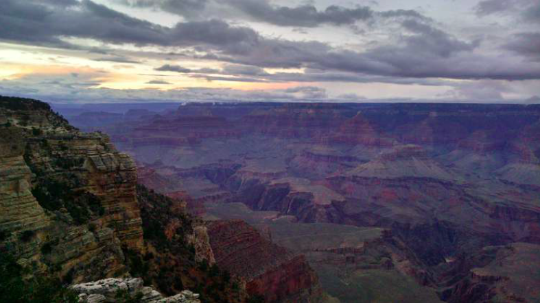
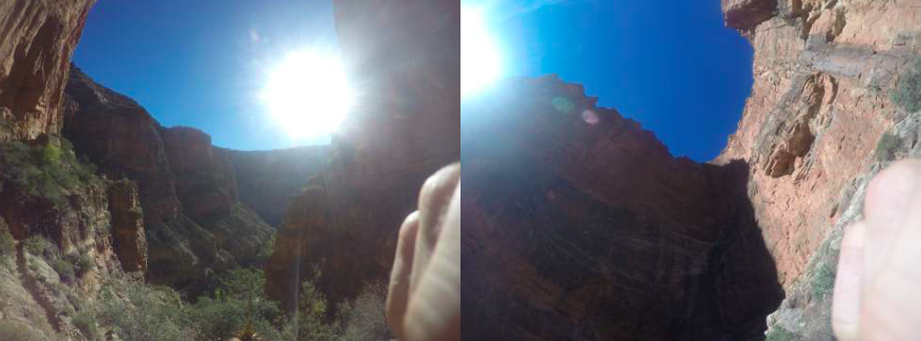
After the tour of the Dam, we drove the next 4 hours or so, getting to the Grand Canyon just before losing daylight. We decided to head straight to the Rim to get a look at what I’d be up against in a couple of days. One word, “Intimidating”.
“What the Fv#% did I get myself into!?!?”
I’m going to try and run all the way over GASP there…. and back….?!?!?!
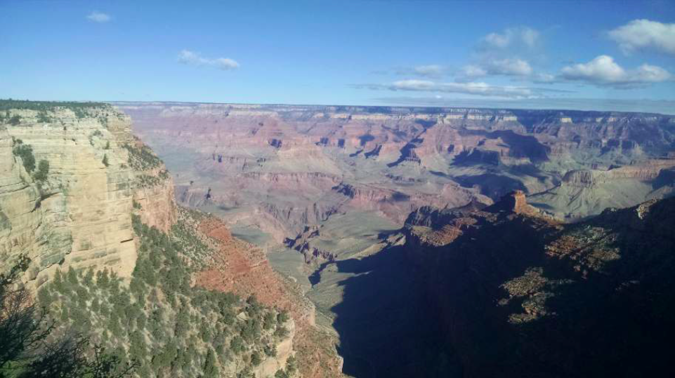
This was the first time I had ever been to the Grand Canyon and oh man, this was going to be hard. As far as you could see across, you could barely see parts of the north Rim. And as far straight down as you could see, you couldn’t see the bottom. Wow! So I have to run DOWN into THAT, then across to over THERE, then all the way BACK? WTF? Friday was fun as we drove near the South Kaibab trailhead (where we would be starting our run early Saturday morning). Jess and I and our boys hiked to the trailhead, then 0.75 miles down in and took a bunch of pictures. We also learned very quickly how treacherous a fall off of that trail would be. And JT and Luke tested those edges and their boundaries as well as the patience of their saintly mom. We also went to the Bright Angel trailhead where we would hope to return before dark the following day.
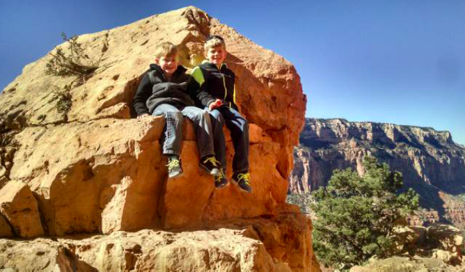
Jess was fine with them climbing rocks as long as they weren’t close to the edge of the trail.
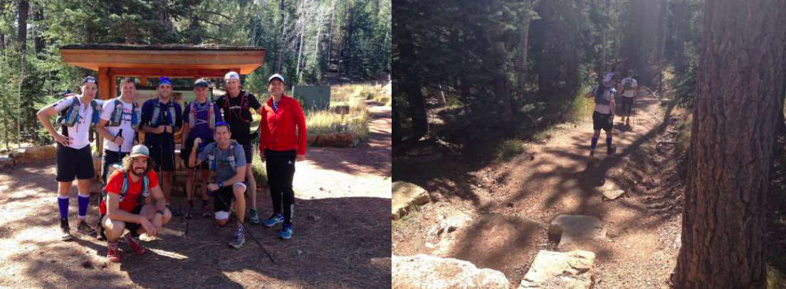
We had a brief planning meeting Friday night and went over some ground rules. Six of our group, which had grown to Seven in total, would meet at my hotel at 4:20AM where my dad would drive us to the S. Kaibab trailhead for a couple of pictures and a 4:30AM departure. Z-man would leave at 6:00AM or so and try to catch us. If he caught us and was on pace for breaking 10 hours for the double crossing, he would continue on ahead and any of the stronger guys of our group could go ahead with him. We also decided that if people chose, they could go off the front of the group, but nobody would be left alone off the back. I had shrunk and laminated a map of the trail for each person of the group that showed all of our elevation and mileage markers of all major landmarks and water stops. I showed them one of these and offered to bring the rest in the morning (ominous foreshadowing of the single lightest piece of important gear I had).
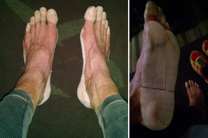
Taped feet after the run
Friday evening I taped every one of my toes as well as the bottoms of my feel and edges of my heels. I did not want to be derailed by blisters. Fully loaded my pack weighed about 10-12 lbs as my philosophy was to err on the side of having extra gear/nutrition “just in case” something were to go wrong and we ended up spending the whole next night out there in that hole.
Here’s what I had for gear:
Garmin 920XT (Time, Distance , Avg Pace, Elevation)
Injinji socks
Hoka One One – Challenger ATR, trail shoes
Rhone running shorts
Team ReserveAid (Zorrell tech t-shirt)
Ear Warmer head-band
Princeton Tec Remix Pro head lamp (2 extra batteries)
Gore thin full finger cycling gloves
Thin Sugoi Long sleeve shirt/jacket
Ultimate Direction SJ race pack
contents:
70oz. bladder, in-line Sawyer water filter and in-line carbon filter
2, 20oz. UD bottles (starting with 1 hour of Infinit Nutrition in each)
Emergency foil blanket
North Face Feather Lite Storm Blocker (waterproof jacket)
Retractable razor blade knife
GoPro Hero4 Silver (extra battery and extra SD card)
12 honey Stinger Gu’s (various flavors)
4 Blueberry Larabars
4 Kind Bars
2 BonkBreaker bars
2 packs of Honey Stinger chomps
2 other random high calorie bars
Black Diamond – Distance Carbon FLZ trekking poles
Blinky light on back of kit and several twisty ties.
3:35AM, I woke up before my alarm and slipped out of my room and went across the hall to my parents room where I could get ready and not wake up the kids. I loaded my bottles of Infinit and grabbed the last of my things. I was outside by 4:10AM where everyone eventually gathered and we crammed into our rental car and headed for the trailhead.
South Kaibab Trailhead, elevation – 7,260’
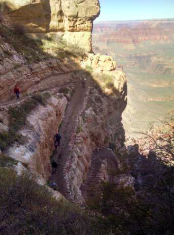
Shockingly, we started our trek at exactly 4:30AM. We were all bit nervous and a lot excited. You’d think starting the day with ~7 downhill miles would be easy, but you’d certainly be wrong. The terrain was STEEP! So your toes were constantly pushing against the front of your shoes. Every ~10-20 feet or so there was a log across the trail as a way of preventing rain water from washing out the trail. Also, every 50 feet or so this created a channel across the path such that after you stepped over the log, the ground behind it was dug down about 12 inches, then about 2-3 feet later you stepped back up over the next log back up to the normal trail height. This might not sound very treacherous, but consider that it was pitch black with only a visual spot illuminated by your headlamp. Pair this with the normal tripping hazards of uneven ground and rocks sticking up and it made it hard to run at any kind of a fast pace. The first 4-5 miles also had a nearly 180 degree switchback every 30 to 50 yds for long stretches at a time. If you overshot any of these switchbacks, you would fall 30 or 50 or 300 feet off a near cliff that was just inches from the trail we were “running” on. We came across an awesome sign about a half a mile into the trip warning people not dare attempt to hike down to the river and back in the same day because it would be too exhausting and dangerous. Good thing I’m not a rule follower!
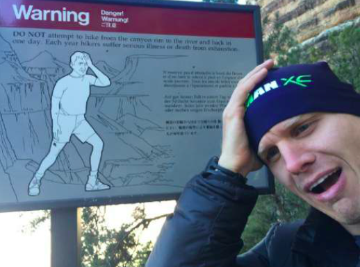
Sign reads: “Warning! Danger! DO NOT attempt to hike from the canyon rim to the river and back in one day. Each year hikers suffer serious illness or death from exhaustion”
Within about 20 minutes we had made it to Skeleton Point (Elevation 4,829’), where we stopped to quickly shed our outer layer. It was about 30 degrees at the start, but just losing a couple thousand feet of elevation and 20 minutes worth of running was enough to warm us up to only need a t-shirt for the rest of the entire day.
We kept making our way down the South rim for what seemed like forever. At one point, I ran up ahead to shoot some video of everyone as they came past. Alone, I turned my headlamp off for a minute and realized how bright the stars and the moon actually were here. If it wasn’t for the rough terrain and certain death from tripping and missing a switchback, it might have been fun to run for a while by the natural moonlight… On the way down we saw a small handful (in total) of hikers making their way up out of the canyon. On a couple of occasions if we looked really high and far behind us, we could make out a few headlamps coming down, but besides that we were pretty much alone in the wilderness. I knew we were getting close to the bottom because I was watching thousands of feet burn off of our elevation. Just as a little bit of light was starting to expose some of the cliff faces as we approached the bridge across the Colorado River (Elevation 2,460 ft).
The water was off when we reached our first intersection. I reached into my pocket to grab my neatly laminated map to determine how far to the next one and… Dammmmmiiiiittttttt! I forgot all six of the maps in my hotel room. Good thing I had “mostly” memorized it as the knowledge of the landmarks did come in handy on many occasions. Just after this mini break, we saw that the main trail was “closed” and we would have to divert through Cottonwood campground. This was a really awesome little spot that had 30-50 tent sites setup right alongside a somewhat loud, but incredibly peaceful bubbling stream. Note to self: Hike down here in a few years with Jess and the boys and sleep over night near this stream… Just after we made it through this camp area, we crossed a bridge across the aforementioned stream and arrived in Phantom Ranch (elevation – 2,500’).
When we rolled into Phantom Ranch, there were a lot of people congregating outside of the single building near the water spout. We took our packs off for a minute and refilled our water bottles. We each grabbed a bar to snack on and chatted with the “locals” (a.k.a. hikers, campers, etc). Everybody seemed utterly amazed that we were really intending to not only go “All the way” to the North Rim, but also go “All the way” back to the South Rim in the same day. (Half of them had ridden a mule and the other half had hiked an entire day to cover the trip we had just done in 90 minutes) I heard the word crazy mumbled several times. When asked why we would do something so ridiculous, the guys made sure to tell everyone that we were celebrating my 40th Birthday (with reactionary looks of utter confusion as to why that would be a celebration). One cool thing about our timing was that we arrived just before the “chophouse” opened for breakfast at 6AM. We had travelled the “easiest” 8 miles of our day in almost exactly an hour and a half. When the person working there opened the door for breakfast and started explaining the rules, we took that as our cue to put on our kits and get moving again. (Phantom Ranch and Cottonwood Campground seems like the least hardcore way to actually experience some of the awe of the bottom of the Canyon).
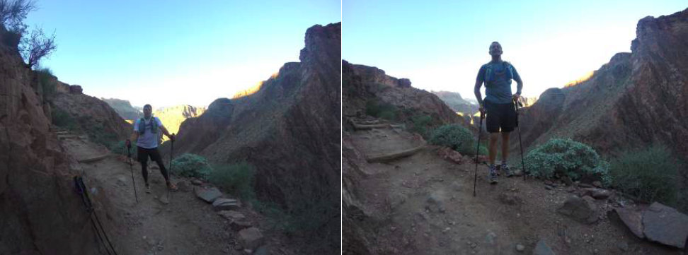
We shed our headlamps as we left Phantom Ranch. Shortly after you leave Phantom ranch you start a very runnable next 7 mile section of North Kaibab trail that takes you on a constant incline up about 2,000 ft where it then turns very steep for the last 5 miles or so (and ~4,000 more feet of gain) to the North Rim. The first ~4 miles or so is called “The Box”. When I wrote that on my map (that I laminated nicely then proceeded to forget in my hotel), I wasn’t sure why it was called that. This was a super cool section of the trip that continues to meander along a stream with several bridge crossings. You are essentially in the “bottom” of the Canyon, if there is such a thing. And instead of having cliff faces that you could fall off, here there are shear and steep and massive cliff faces that you run along the bottom edge of. It’s hard to describe, how amazing is to have such a massive straight up wall of rock just inches from your one shoulder. And if you look across the small stream, there is nothing but another massive rock wall that goes up for hundreds and hundreds of feet. We were all still running pretty well through this section, but you could already feel the miles starting to add up. It was probably mid forties temperatures as we made our way through this section and the sun eventually started to find us.
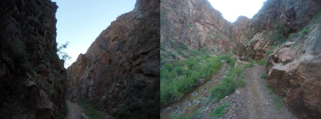
Running through “The Box”. If you look closely at the picture on the right you will see the other 5 runners of our group up ahead on the trail.
We stopped for a couple of minutes to regroup again and refill our water and grab some nutrition out of our packs near Ribbon Falls Station (Elevation 3,720’).
Not long after exiting “The Box”, we came upon a girl hiking/running towards us on the trail. As was our rule for pretty much the whole trip we stopped to chat (sometimes it was for 10 seconds, sometimes it was for 2 minutes – meeting all of these different people were some of my favorite few minutes at a time of the trip). Anyways, this particular girl was youngish, probably mid-twenties, and very “crunchy” or “hippyish”. She had a few dreadlocks and a tattoo inside the top of her ear. I looked down and she was wearing a pair of Teva’s (sandals). She proceeded to tell us that she left the South Rim “Alone” around 10PM the night before and had already been to the North Rim and was on her way back. She had done the double-crossing once before with a friend in about 18 hours but that she was hoping to do it in ~14 hours today. She joked that being alone, she may have started hallucinating a bit. She said her secret to a successful crossing was to have 2 pairs of shoes. She said she had done the first 20 miles in her Vibram 5-Fingers (toe shoes). I doubt she had the extra weight in her ratty pack of a safety foil blanket, water filters or razor knife! For all I know she was eating dirt and rocks and drinking from streams. Way to make a group of over-prepared middle aged men feel like a bunch of wimps! We saw many groups of hikers along the way. Groups of anywhere from 2 to 8 people of ALL ages, but most were 50-65 yrs old. Their packs looked so huge (most of them were carrying upwards of 60lbs). Most of them thought we were crazy to do R2R2R in a single day. We proceeded to tell them that we thought they were crazy for camping for anywhere from 4-10 days in the bottom of the Canyon. Again, these brief chats were some of the best highlights of our day.
When the grade started to creep up, our group started to spread out a bit. You always had somebody to run with and somebody was always stopping here or there to take a picture or short video or to grab a quick bite to eat. We made sure to remind each other every 30 mins or so to drink or stay on top of our nutrition. We briefly stopped again at the Pump House Ranger Station (Elevation 4,080 ft) to refill our water and chat with a few more hikers. This is where the real ascent started. We took our trekking poles out of our packs and got to work. We were all still running, but something strange started happening. Allen was pretty much the strongest runner all day. The rest of us mixed it up most the day, but I was certainly one of the weaker(est) runners of the group. I wasn’t necessarily slowing people down much, but I certainly wasn’t the one pushing the pace either. Eric and I had both passed our friend Evan who is a really strong and very fit dude. I thought at first that he was just slowing for a picture or some video, which he had done several times throughout the day. After a few more switchbacks, Evan said, “do you mind if we stop for a minute for a little breather”? No problem with any of the rest of us, so we caught our breath and we’re ready to go in 30-60 seconds and Evan didn’t look so excited to start moving again so quickly.
Now for the back story… Evan didn’t show up for our short meeting the night before. He sent us a text message that he wasn’t feeling well so he’d rather just go to bed early and get a really full night of sleep and we didn’t think much of it. Evan was certainly fine for the first 17 or so miles, but started to slow uncharacteristically as we started to get higher and higher in elevation. I was personally happy that I had put “Elevation” as one of the cells on my watch as this seemed to be a more reliable indicator of where we were than “distance” because of all of the gps distortion in “The Box”. Not to mention that a 3% incline mile is NOT the same as an 18% incline mile.
Anyways, back to our climb… After another 500 or so feet of gain, I couldn’t see Alan, David, or Jess (not my wife “Jess,” but one of my buddies who happens to be named the male version of “Jess”) up ahead anymore. We made another switchback and Evan asked if we’d be willing to stop again. Uh oh. I’m supposed to be the one hurting here, not Evan. Both Eric and I felt fine (I actually felt shockingly good at this point), but Evan was having trouble recovering. His HR stayed high and his breathing was a bit labored even after a brief stop. We finally made it to the next water station which is only about ~3 miles and 2,500 ft from the top and met back up with Allen, David, and Jess who had waited for us. We all refilled our bottles again and had a short chat with 2 girls who had camped in the Canyon together for the last week and were now on their way out. Only 3 “short” miles from their car which would take them to the Hamburger, Beer, and shower which according to them they so desperately needed (who were we to disagree).
Even after a several minute break, Evan looked reluctant to start moving again. We assumed our positions with Allen, David, and Jess leading the way, with me and Eric and Evan in back trying to keep up Before I get too side tracked, I want to make sure that I say that I thought the last 5 miles or so of the North Rim trail were some of the most spectacular views I had ever seen. This was without question my favorite part of the Canyon. I realized in this section of the trail how tame the South Rim actually was. I mean seriously, most parts of the South rim if you actually fell off the trail, you’d probably only make it 20-50 feet before you landed onto a different switchback up ahead on the same trail you were currently on. If you fell off the North Rim trail, you were falling hundreds and hundreds of feet down into the Abyss. There was going to be no hard trail to break your fall in 30 feet and they’d be lucky to ever find your body. It was AWESOME. The edge of the trail also seemed to be immediately on the cliff edge with no margin of safety in between. I don’t want to give the impression that it was unsafe. I’m not afraid of heights and at no time did I feel unsafe, but it was a little “unnerving”. And did I mention AWESOME?
Pictures do not do it justice
We moved closer to the top (above 6,500′) and the air certainly started to feel a little thinner. I felt okay, but was definitely slowing a bit. Eric stopped at a tight switchback just up ahead and was looking back. As I came up to him he looked behind me, then back at me and said, “you go ahead. I’ll meet you at the top and I’ll stay with Evan and make sure he makes it to the top”. Part of me felt guilty and figured I should also stay behind with Evan. Part of me was relieved because I was also starting to feel “not great” and I just wanted to power up to the top and get my much needed Snicker’s Bar and Beef Jerky! One of the smarter things we did as a group in the weeks before this adventure was identify a local R2R2R expert and picked his brain for ideas and advice. We pitched together a bunch of cash and paid all of his expenses and a little extra for his time and he agreed to meet us on the North Rim and have an “Aid Station” ready for us when we got there. We each told him what we wanted a week in advance and he was going to have it waiting for us when we got there…
For the last couple of miles and couple thousand feet of climbing I just put my head down and worked my way to the top. My trekking poles were super helpful and honestly I can’t remember if I was slow running or fast hiking, but I was moving forward at a reasonable pace given the incline and gradually thinning air… I knew I was getting closer to the top when the people coming down the trail towards me started looking less like “hardcore hikers” and more like “tourists” carrying cameras and not wearing packs. Each time I asked how close to the top I was and each time, the people had no idea… Finally as I came through a final shaded, wooded area I saw two people who answered my question with “It’s only about 50yds up ahead around that corner”.
North Kaibab Trailhead (Elevation – 8,241 ft). ~22 miles and 6:32:00 into our day.
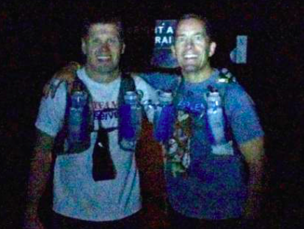
Wow! I had finally made it to the halfway point. All-in-all, I felt pretty good and was met by Benedict who was waiting for us us on the rim. He had a big smile, snapped a picture, and then led me over to the trunk of his car where he had a cornucopia of deliciousness setup for us. Most of my buddies were there already and I dug into a bag of salty potato chips and ripped open a Snickers Bar. I split a bottle of Coke with David and refilled my bottles with Gatorade. A few minutes after I got to the top, Z-man crested the hill and came over to the group. He had left ~1.5 hrs after us, but arrived at the North Rim while we were still there. It had only taken Z-Man 5 hrs and 6 minutes to make the crossing, but he had no plans to hurry at the top and race to the other side. He looked trashed! He had basically sprinted the last 5 miles up the North Rim and he looked in pretty bad shape. He decided then and there that his “fast” day was over and he’d simply enjoy the camaraderie of the group for the return trip back to the South Rim. We all chatted and ate and waited and waited and still no Eric and Evan… I started to wonder how I was going to break it to Evan that he should NOT make the return trip with the group.
After what seemed like a very long 20-30 minutes, Eric came up through the trailhead with Evan in tow. Eric made eye contact with me with a disappointed look on his face and made a cutting motion with his hand across his neck as he mouthed the words “Evan is done for the day”. I was disappointed for Evan, but was somewhat relieved that he was smart enough to make the decision to call it a day on his own and not jeopardize the safety of the rest of the group in the proceeding 24 miles. As soon as they made it to the top, Evan sat down on a large rock and slumped his head. The rest of us helped Eric get the nutrition he needed. Evan wasn’t interested in eating anything. After 5-10 minutes of sitting on that rock and catching his breath, I helped him calculate his HR, which was still sitting around 135bpm. Evan clearly had some sort of virus or illness. Most people get winded just walking up a flight of stairs when they are sick, but Evan managed to run 22 miles which included ~6,000 ft of gain into relatively thin air above 8,000’ of elevation. Thank goodness we arranged to have somebody meet us on the North Rim. What we thought was just going to be an aid station and an “insurance policy” turned into a ~4hr taxi ride back to the South Rim for Evan.
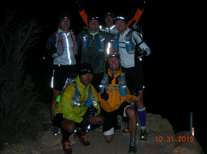
Just before (left) and after (right) we left the North Rim for the return leg…
After a few pictures, we geared back up and hit the return trail. It was A LOT faster heading back down, but not necessarily “easier”. Within the first mile, I was running with David and he twisted his (previously injured) ankle from a weird landing on a rock or log. Luckily he was already wearing a brace and it wasn’t as bad as originally thought. He was extra careful for the next steep 4+ miles.
This section of the Canyon was certainly my favorite and the view is even better coming down than going up since you can see out down into the canyon and the trail below versus going up where you mostly just see the trail immediately in front of you. I decided to keep using my trekking poles for this downhill section as well and got into a pretty good rhythm. We were all running pretty well and continuing to enjoy our day.
It only took us ~25 minutes to make it down to the first water stop (it had taken us 47 minutes to travel this same distance going up). We only stopped for a minute or two to chat with some hikers who were there then were off again. Even though it was crushing our quads and our toes, we continued to make good time down to the Pump House Ranger Station campground where we stopped again to regroup. Eric inserted a little levity after using the “facilities” at this stop. When he came out, there was a long piece of toilet paper hanging out of the back of his pants as he walked over to the spout to re-fill his bottles. We were all cracking up until we eventually realized that he had done it on purpose.
We ran alongside this stream for ~7 miles on the N. Kaibab trail.
We were off again running towards “The Box”. We had now been running “downhill” for almost 10 miles and it had started to take its toll on some of us. I still felt shockingly good given on how far up and down we had gone, but Eric was now starting to slow more than most. As we entered The Box, it was evident that his quads were not in a good place. Eric, Jess and I ran together for a while, but Eric needed a few walking breaks and eventually Jess stretched the gap between us and disappeared around a rock face corner. Before he had left I told him not to wait for us and that we’d see him at the top. As The Box closed in around us, I was now in triage mode with Eric’s legs. I tried to stay just far enough ahead of him to provide a carrot for him to keep running. We chatted and simply kept moving forward. These were a LONG 4 miles and I was surprised to see that the guys were all waiting for us at Phantom Ranch when we got there.
Phantom Ranch, 3:07PM (Elevation 2,500 ft, mile ~35)
I was glad to be back at Phantom Ranch. The guys were each enjoying a cold lemonade and they had 2 extra cups waiting for us (constantly shooing thirsty bees away). When I walked inside to fill mine up, I was surprised to see many of the people from this morning drinking beers and hanging out. They all seemed to recognize me as the “Birthday Boy” and couldn’t believe that we had been running all day already. I headed back outside to grab a quick Oreo flavored Bonk Breaker bar and enjoy my cold lemonade, then reluctantly we decided to get up and go. We had a mini-debate on which route we should take. South Kaibab is ~2 miles shorter and presumably steeper, but there is no available water on the route. Nobody really wanted to do the extra 2 miles to take the Bright Angel trail, but we also knew that there were 3 potential places to refill our water, not to mention our cars were parked near this trail head as it was our original plan. Over David’s dissenting vote, we decided to stick to the original plan and make our way up the Bright Angel trail. We were moving much slower this time as we made our way back through the Cottonwood campground. A right turn at the next intersection took us to the large bridge across the Colorado River, which looked much bigger and angrier in full daylight.
Just after we crossed the river, I stopped several times for minor things. Once, Jess helped me get my poles back out, another time to put my GoPro away and a final time to water the rocks… Needless to say, this caused a bit of a gap between the fast guys (Z-man, Allen and David) and the “less fast” guys of me, Eric and Jess (thanks to our delays). When we finally got to the start of the switch backs, we could see the other guys just a few layers up. Jess was chomping at the bit to move ahead and I told him in no uncertain terms this time to go ahead and not wait for us at the next stop. I assured him that Eric and I were fine and that we would make it to the top together, no matter how long it took.
After ~20-30 more minutes, the guys up ahead were out of sight and Eric and I were alone to finish our trek. At this point we had gone ~41 miles, but the hardest 5 miles were still ahead of us. It was around this point that my watch beeped a “low battery” warning. What?!? My Garmin 920XT is supposed to be good for ~20 hours… It turns out I had forgotten to turn off the Bluetooth and WiFi signals. So it must have been searching for signals for the last ~11 hours. I stopped briefly to turn these off and now had something to worry about for the remainder of the trip. Those who know me will know that I’m a data geek. If this run file doesn’t make it onto Strava, then “it didn’t happen”… Good thing Eric has been wearing my 910XT and we have essentially run the same route in the same total time so far, so I at least have a data backup plan if my watch doesn’t make it. The grade had really picked up and Eric and I collectively realized that “running” wasn’t any faster than “hiking” at this point of the day. So that is what we did for the rest of the time.
Gab had previously coined the term “Angry Man Walk”. This is when you are walking up a hill in a race, but walking with a purpose. Essentially, you grit your teeth, swing your arms and walk like you are an angry man. You’d be surprised how much faster this is when compared to a leisurely walk… So here we were, two “old men” doing the “Angry Man Walk” up out of this hole. I’ve run hundreds and hundreds of training miles with Eric over the years. In many ways, I was happy we got to spend these difficult miles together. Our legs were shattered, but our spirits were light and strong. We shared stories and pointed out the cool views. This is definitely an amazing place for an adventure.
JW& Eric ~12.5 hours into the trip coming back up the Bright Angel trail
At the Indian Garden Campground (elevation, 3,800’), we only stopped long enough to refill our bottles and get moving again. The light was getting thinner and I think we were each hopeful that we’d finish in the daylight. We fought the urge to get out our headlamps and kept hoping our eyes would adjust and we could make it. But unlike ~13 hours earlier, there were no stars and no moon to guide us. I finally gave in and stopped to put my headlamp on, but Eric was still too stubborn. He was falling behind a bit, but I kept cutting any breaks he wanted short in an effort to get this over with. The headlamp certainly helped with the footing and eventually I convinced Eric to put his on (and he thanked me for bullying him into it). It sure didn’t feel like we were moving very fast, but every single time we saw lights I made it my goal to track them down and pass them. Another watch battery warning and more motivation to get to the top quickly. You could tell we were getting closer to the top by the density of other runners/hikers and that the elevation readout on my watch had ticked past 5,000’, then 6,000’.
When we were about a mile from the top, we finally caught a set of headlamps that were up ahead. We stopped for a few seconds to chat with them to learn that these two guys had started their R2R2R trek at 10PM the night before. They were over 20 hours and ~45 miles into their “run”. They were 62 and 72 yrs young… I joked with Eric that I hoped that would be us in ~20 yrs or so.
Not a whole lot of talking in this last couple of miles… And at ~20 min/mi, it takes a LONG time to travel just 2 miles. As we got to the stone archway, I thought we were very close to the top, but I know in hindsight that we were still ~15 mins away. There were a lot more people on the trail now and most of them were “tourists” with no backpacks or even a water bottle. I could see resort lights off in the distance and figured there must be a few more switchbacks until we made it to the top when, bam, we were at the trailhead. I think this was the only time of the day when I was surprised that it was actually shorter than expected!
We were super excited to have made it to the top. 14:43:45 after we had started. We had finally made it. Eric let out a primal scream and then we hugged and congratulated each other. After about 4-5 different attempts at getting a passer-by to take our picture (with a flash), this is the best we got…
This is the only picture I have of me and Eric at the finish at the Bright Angel Trailhead
Bright Angel Trailhead (Elevation, 6,860’) ~7:15PM
We had parked Eric’s car near the trailhead the night before, but these couple of hundred yards to find our stashed keys and get to the car seemed a lot harder than the last couple of miles of Angry Man Walking… Most of the guys were meeting for pizza and beers, but I wanted to get back to my room to shower and see my very tired kids before they went to bed. Instead of going back out, I ate 2 pieces of cold leftover pizza and a Slim Jim as my lame recovery meal… I had exactly zero beers before falling asleep by 9:00PM.
My GPS file from the run: STRAVA
Video Account of our day: YOUTUBE
Lessons Learned:
R2R2R was an awesome adventure, but honestly, I think I would have enjoyed it more if I just did R2R (South to North). This would have allowed us to leave in daylight and take extra time throughout the trip to take in more sights and pictures, etc. The first crossing was awesome, but the last 5+ miles of the return trip were a bit of a death march.
I took WAY too much stuff. We got lucky with perfect weather and conditions with all water stops being open. But I arrived at the finish with ~10 gu’s, and 5-6 bars still remaining in my kit. I didn’t need my waterproof windbreaker or the long sleeved shirt I started with. I didn’t need the water filters, or the water bladder in the back. I didn’t need the foil blanket or the razor knife. So if I were to do this again (which I won’t), I would still take one long sleeved shirt OR wind breaker, and no rear water bladder, and a lot less nutrition.
Paying for the “insurance policy” by having someone meet us on the North Rim was the smartest single decision we made as a group in the weeks leading up to our adventure. It was worth every penny just to have a coke, snickers bar and potato chips at the halfway point. But the fact that we weren’t stranded out in the middle of nowhere with someone hurt (or in our case an illness) would have been worth 10x what we actually paid.
I am SO glad that I took the hour the night before the run to tape my feet. I got exactly ZERO blisters after nearly 15 hours of running with ~11,000’ of up AND down. I had worn a hole through the toe of my Injinji sock where my big toe rubbed my shoe on the downhills, but the tape protected my skin like a charm.
I’m very glad I had trekking poles (and practiced using them for weeks beforehand). These were good for balance/rhythm on the moderate downhill sections. They were AWESOME for all of the big steep climbing sections within ~5miles of each rim.
Have a fun group. The group of guys I went with were AWESOME!!! We had a lot of fun and camaraderie throughout the whole day. There was not a single ego in the group and we were all there to simply enjoy the day and do something epic.
The R2R2R is NOT a race. This might be the first time of my life that I absolutely did not care what my finishing time was. I think if you do this run and are too focused on getting it done quickly you will miss the whole point. The views were awesome and ever changing. And some of my favorite moments of the day were simply stopping and chatting with the other passers by. There were people of all ages and abilities out there enjoying the Canyon. Each had their own story and all were friendly.


Leave a Reply